APPENDIX G
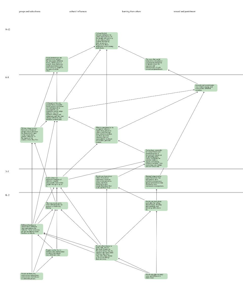
The Strand Map Service (SMS) provides an interactive graphical interface that helps K-12 teachers and students understand
the relationships between science concepts. The interactive maps are available through a public Web 2.0 JavaScript API
and a REST API that lets developers embed the maps in Web sites and display educational resources and other content in
the maps.
See strandmaps.nsdl.org

Source:strandmaps.nsdl.org, accessed 2012-11-11.